
Since completing my first solo backpacking trip and announcing to my family and friends that I’m embarking on an Appalachian Trail thru-hike in 2023, I’ve received a barrage of questions about my trek that are worth addressing. But first, for those who don’t know me, an introduction is in order.
Who am I?
My name is Elise. I am an attorney who, up until recently, lived and worked in New Hampshire. While in New Hampshire, I got really into hiking and camping. My husband, myself, and our golden retriever would depart for the White Mountain National Forest at horrifically early hours of the morning in order to make it to the mountains before sunrise. We completed 6 of the New Hampshire 48 (48 mountains over 4000 feet tall) and a handful more of the 52 With a View (52 mountains under 4000 feet tall with beautiful views). At some point during this time, I began to dream about hiking the AT. I read books, listened to podcasts, and watched Wild starring Reese Witherspoon (about the Pacific Crest Trail, not the AT, but I digress). In the summer of 2022, my husband’s job took us to Texas. I cannot practice law in Texas, and so I thought more seriously about hiking the AT. The timing seemed perfect: my husband and I have no kids, we are financially secure, and I am leaving no job. If not now, then when?
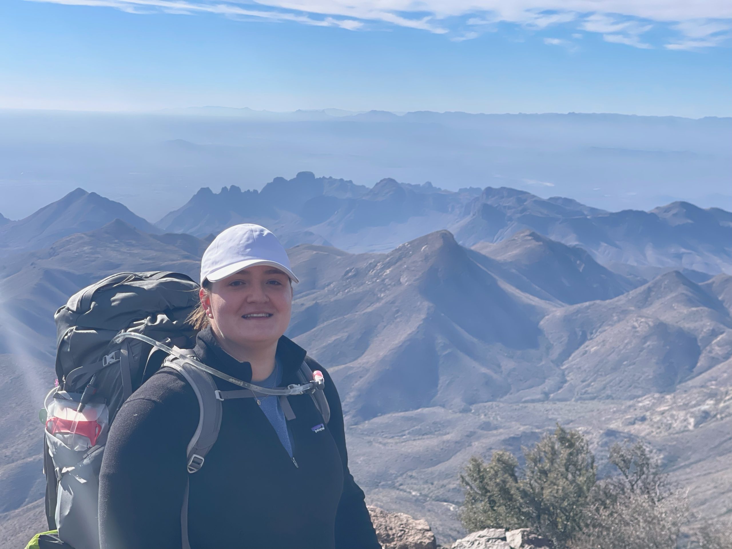
Me on the South Rim Trail of Big Bend National Park.
What does it mean to thru-hike the Appalachian Trail?
The AT is a 2,198.4-mile long footpath that traverses 14 of the eastern United States, running from Springer Mountain in Georgia to Mount Katahdin in Maine. It takes, on average, 5 to 7 months to hike. A continuous hike is what’s known as a “thru-hike,” as opposed to a “section hike,” in which the AT is hiked in parts over time. The AT can be hiked northbound (“NOBO”) from Georgia to Maine or southbound (“SOBO”) heading the opposite direction; an overwhelming majority of thru-hikers to hike NOBO for a variety of reasons, including the relative ease of starting in Georgia over New England (which is largely considered the hardest part of the trail). While the AT can be hiked year-round, most NOBO thru-hikers, such as myself, leave Springer Mountain in March and April. The hike must be finished by mid-October, when the winter weather in Maine makes climbing Mount Katahdin too dangerous.
When I tell people all of this, it naturally leads to a number of questions.
Where will you sleep? I will carry a tent and plan to sleep in it most nights. The AT also has approximately 250 primitive shelters and lean-to’s set either on directly on the trail or a short distance away. Additionally, I expect to spend about one night per week in hiker hostels, motels, and/or hotels to rest and resupply, shower, do laundry, and charge my electronics. These accommodations are typically very close to the AT and service many thru-hikers each year.
What do you eat? A variety of foods! I will carry all of my food in my backpack and will carry a 3-5 day supply at a time. My food must be calorie dense (to provide the energy to hike 12-15 miles per day, on average) and lightweight. Many hikers eat foods such as ramen, instant potatoes and rice, Knorr’s sides, nut butters, tortillas, oatmeal, cookies, and candy. I expect I will too. However, because I love to cook, I’ve been dehydrating a number of my favorite meals. These meals are already cooked and seasoned, so all I need to do out in the wilderness is add hot water and wait a few minutes to soak. I will package them into individual serving bags before I leave for the AT so that they can be mailed to me at various points along the trail. Finally, I will also carry electrolyte and salt packets to keep myself appropriately hydrated.

Before and after dehydration: white bean, carrot, and mushroom stew. Just add water and enjoy!
Where do you get your supplies on trail? The AT frequently crosses over, or passes near to, towns with convenience stores, grocery stores, and/or outdoor outfitters from where I can purchase food and supplies. Some hiker hostels may also sell such items or may offer shuttles into nearby towns so that hikers can shop and resupply. I anticipate going into town about once per week. I also expect to receive packages from home with supplies such as my homemade food, extra contact lenses, and any gear that I may want to swap out. Similarly, I can order replacement gear or items online and have them shipped to me. I can receive these packages at most hostels and outfitters for a fee, or by general delivery at a post office in a town near the trail.
What equipment will you be carrying? You can view my most current gear list here (and more to come regarding my gear choices), but broadly speaking, I will be carrying: a tent, sleeping bag, inflatable sleeping pad, 1 set of hiking clothes, 1 set of sleeping clothes, a puffy jacket, extra socks, a bear canister (for storing my food), a kitchen set (consisting of a 2-cup pot, camp stove, and fuel), a water filter, 2 water bottles, camp sandals, a custom first-aid kit, a small hygiene kit, and assorted electronics. If that sounds like it’s not a lot, it’s because it isn’t! I don’t explicitly aim to be an “ultralight” (sub-10 or 15 pounds carried) hiker, but I do want to keep my total weight, inclusive of food and water under 25 pounds.
Where will you get your water? I will filter water from sources along the trail. I anticipate carrying at most 2-3 liters of water, and stopping to filter as needed. Water is abundant on the AT, so, for the most part, carrying more than that is not necessary.
How do you navigate? The AT is famously well-marked with painted white blazes on trees or rock cairns where painting on trees isn’t feasible. One could hike the entire trail without the assistance of a map by just following the white blazes and other posted signs. Some hikers bring AT guidebooks (the most common being AWOL’s “The A.T. Guide”) to assist their hike. These guidebooks help hikers plan ahead by detailing elevation gain and loss at certain miles, important viewpoints or waypoints, reliable water sources, distances to shelters and campsites, and contact information for hostels, outfitters, and more. More common today is the use of apps, specifically one called FarOut. FarOut shows the same information listed above, but with the added benefit of being a pseudo-social network. For instance, instead of merely noting that a water source is at a specific mile-marker, FarOut allows other hikers to leave comments indicating if that water was poor or abundant. I will certainly use FarOut; I have not decided if I will also bring a physical guidebook.
What about safety? I would be lying if I said I was fearless about an AT thru-hike. From injury and illness to getting lost to, the most common fear posed to me by non-hikers, stranger danger, a 6-month thru-hike is certainly not a walk in the park. I do think that many of these fears can be prevented. Permethrin treatment on gear and clothes can ward off ticks; basic first-aid knowledge, a small first-aid kit, and a satellite communicator can be invaluable in times of injury or emergency; and properly storing my food can drastically lower the (already very low) chances of a bear attacking my campsite. Communication networks through FarOut, ridge runners (volunteers and park employees who patrol sections of the AT), hostel owners, and other hikers also helps me stay aware of trouble. Additionally, trusting my gut and using common sense, not sharing my planned itinerary with anyone who doesn’t need to know, and posting trail updates after I’ve already passed through the area will help greatly.
How are you preparing? Physically, I am preparing by taking near-daily walks with a heavy backpack and doing strength training and other cardio activity a few times a week. I have taken two overnight camping trips since deciding to hike the AT, and plan to take at least one more before I depart. I am testing out my gear to figure out what works and what doesn’t, and trying to whittle down both my pack weight and my body weight to make my carried load lighter. Mentally, I am thinking about my “why” (as in, why am I hiking the AT to begin with) and my goals, reading the stories and experiences of other thru-hikers, and imagining myself on the trail at all times: both the beautiful and sunny days and the rainy, miserable ones. I am imagining what is in store for me on the trail and how my life might be different when I return.
Are you nervous? Yes, absolutely! But I am also excited. Hiking almost 2200 miles in 6 months is a huge undertaking. At the time of this publication, I am less than two months away from embarking on this adventure of a lifetime. I am ecstatic and grateful to be able to embark on this journey, and thankful to all of my friends and family who are supporting me along the way.
Until next time!